Introduction
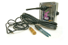
Scientific experiments are only as good as the data they collect. Therefore, getting good data is a priority for scientific experiments. But getting good data in ecology creates challenges. Ecologists are primarily concerned with the natural world, so observations and experiments that take place out in the natural world are very important. Ecologists often work by visiting research sites, designated places in the natural world where they observe and measure organisms and their environment. Wireless sensor networks can revolutionize soil ecology by providing measurements at temporal and spatial granularities previously impossible. This paper presents an experimental soil monitoring network we developed and deployed in a Baltimore urban forest as a first step towards realizing this vision. Each network node measures soil moisture and temperature every minute and stores the measurements in local memory. Raw measurements are periodically retrieved by a sensor gateway and inserted to a database in which a calibrated version is also derived and stored. The measurement database is available to applications through Web Services interfaces.At a high level, our experiment was a scientific success, exposing variations in the soil micro-climate not previously observed. However, we encountered a number of challenging technical problems: need for low-level programming at multiple levels, calibration across space and time, and cross-reference of measurements with external sources. These problems must be addressed before sensor networks can fulfill their potential as experimental instruments that can be deployed by scientists without major effort or cost. Lack of field measurements, collected over long periods of time and at biologically significant spatial granularity hinders scientific understanding of the effects of environmental conditions on the spatial and temporal heterogeneity of the soil ecosystem. The recent emergence of Wireless Sensor Networks (WSNs) promises to address the ecologists' predicament through a fountain of measurements from low-cost wireless sensors deployed with minimal disturbance to the monitored site. During the Fall of 2005 we set out to evaluate the validity of this claim through a proof-of-concept WSN built and deployed at an urban forest. The end-to-end system we developed includes motes that collect environmental parameters such as soil moisture and temperature, static and mobile gateways that monitor the health of the network and periodically download collected measurements through a reliable transfer protocol, a database that stores collected measurements, access tools that allow us to analyze the data, a web site that serves the data and tools to the Internet so that others can use the data, and tools to monitor the network. The unique aspects of our system are: (1) Unlike previous WSNs, all the measurements are temporarily stored on each mote's local flash and are periodically retrieved with a reliable transfer protocol [Cardell05]. (2) Sophisticated calibration techniques that translate raw sensor measurements to high quality scientific data. (3) The database and WSN are accessible via the Internet, providing access to the collected data through graphical and Web Services interfaces. We acknowledge that this system is only one link in the long chain of steps from collecting raw measurements to scientifically important results, but it shows great promise in improving ecology science and also ecologist's productivity. However, today the project has one ecologist and several supporting computer scientists, a trend we are working to reverse. The Need for Monitoring in Soil EcologyThe most spatially complex stratum of a terrestrial ecosystem is its soil. Soil harbors an enormous variety of plants, microorganisms, invertebrates and vertebrates. These organisms are not passive inhabitants of the soil: their movement and feeding activities significantly influence the soil's physical and chemical properties. Because soil is an important water reservoir in terrestrial ecosystems and thus an important component for surface and groundwater hydrology models [Cardell05b], interest in the behavior of soil biota spans multiple scientific disciplines.It has been observed that soil organisms are patchily distributed in all three dimensions. Such variations can be either due to biological mechanisms or they are the result of differences in the physical environment, since many soil invertebrates are sensitive to such abiotic factors as soil moisture, temperature and light. For this reason, any field study on soil biota includes background information on the weather, soil temperature, moisture, and other physical factors. These data are usually collected by a technician visiting the field site once a week, month, or season, and taking a few spatial measurements that would be subsequently averaged. These techniques are labor-intensive, and do not capture the underlying spatial and temporal variations at a biologically meaningful scale. Moreover, frequent visits to a site disturb the habitat and may distort the results. RequirementsWSNs promise inexpensive, hands-free, low-cost and low-impact data collection -- an attractive alternative to manual data logging, in addition to providing considerably richer data. However, to be of scientific value, the data collection system design should be driven by the experiment's requirements, rather than by technology limitations. Following this principle, we present a list of key requirements that soil ecology sensor networks must satisfy:Measurement Fidelity:: All the raw measurements should be collected and persistently stored. Should the scientist later decide to analyze the data in a different way, to compare it to another dataset, or to look for discrepancies and outliers, the original data must be available. Furthermore, given the communal nature of field measurement locations, other scientists might use the data in the future in ways unforeseen at the time when the original measurements were taken. Generally speaking, techniques that distill measurements for a specific purpose, potentially discard data that are important for future studies. Measurement Accuracy and Precision: To support ecologicalresearch, temperature data should have accuracy of at least0.5°C, and volumetric moisture data should be given within 1%. While temperature variation of half a degree does not directly affect soil animal activity, soil respiration exponentially increases with temperature, so half a degree makes a big difference in that case. Therefore, raw measurements need to be precisely calibrated, to give scientists high confidence that measured variations reflect changes in the underlying processes rather than random noise, systematic errors or drift. Fusion with External Sources: Comparing measurements with external data sources is crucial}. For instance, soil moisture and temperature measurements must be correlated with air temperature, humidity, and precipitation data. Animal activity is determined by these factors as much as by soil temperature and moisture. In the case of hydrology models, one can only make sense of soil moisture if precipitation data is available. In addition to "traditional" external data sources, data from other WSNs can be integrated with the results collected from the local WSN. For this reason, collected data should be exported using a controlled vocabulary and well defined schemata and formats.
|